Instruction
1
Find documents related to your land site. It can be a cadastral passport, certificate of ownership, a contract under which the land was acquired. If the plot was carried out any operations, he was definitely registered in cadastre, this means that the cadastral number he has and what he is reflected in these documents as necessary in their design.
2
If the document is not, use the website of Rosreestr (www.rosreestr.ruto know the cadastral number of your land. Find on this site left a link "Background information on real estate in the on-line" and go for it. A form appears through which it is proposed to obtain information on the land. This can be done by entering in the corresponding field of cadastral numbers, identification numbers, or the address area. Enter the information you have (reference number or address) and click on the "Create request". So you know all the information available on your site.
3
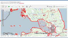
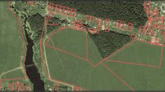
On the website of Rosreestr there is another service - search of the site in the public cadastral map. This can be done on the cadastral number or address. Thus, if you want not only to learn but also to see the location of your site on the map and correlation of it with others, click on the link "Public cadastral map" and enter the information.
4
It so happens that the website does not give any information on your parcel of land. It is likely that your land is simply not registered in cadastre. To find out, go to the cadastral chamber at the location of the land and make a request for information on it. Information can be obtained in the form of the cadastral passport or a cadastral extract. For this the individual must fill out the appropriate form (issued directly at the land register) and pay a fee - 200 rubles (the receipt you can get there). Five working days you will receive a document from which you will be able to know either inventory number or the fact that the plot is not worth taking. These documents may also be obtained via the website of Rosreestr, clicking on appropriate links and fill in our simple form.
Note
Cadastral number of the land plot is a unique, not repeating in time and in territory of the Russian Federation the number of the land that is assigned to him in the implementation of cadastral registration in accordance with the procedure established by the legislation of the Russian Federation and remains until the land exists as a single object of registered rights.
Useful advice
Cadastral number of the plot is a long string of numbers and dots, and their meaning is not always clear to the average citizen. During the cadastral division of territory of the Russian Federation of a particular part assigned a number. Units of such a crushing serve districts, regions, districts. Therefore, the cadastral number of the land plot consists of County, district, quarter, as well as the site itself. The numbers are separated from each other by colons. For example, 50:22:03:001.
