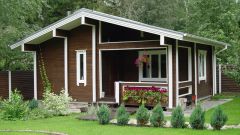
Land as property
Houses and apartments are also objects of real estate and to identify them easy to the postal address, but here is how to determine the boundaries of your land, especially when it is located, for example, in the open field? To formalize this property, you will need to prepare all the necessary documents for setting it in the cadastre. In addition to legal documents, you will need to submit to the registration authority – the territorial Department of Rosreestr cadastral passport or the landmark plan, which contains information about the ground area, the description and the drawing of its boundaries, indicating the coordinates of each turning point.
The coordinates of the turning, or nodal, points of parcel boundaries can be clearly "linked," as surveyors to the area. The plot, the coordinates of which are known, can be plotted on a map, its location can be uniquely identified, and it thus can be registered as the property with the assignment of cadastral numbers.
The information contained in the cadastral plan
Cadastral passport and boundary plans are made geodetic organization, having the admission on the production of such kind of works. To determine the coordinates of the plot the representatives of such organizations, equipped with geodetic instruments, go to the area and produce the survey. It is not only to locate, but in the actual negotiation of boundaries with adjacent land users – owners of neighbouring plots. This procedure can cause disputes between neighbours, so it is important as soon as possible to register their land and get on a landmark plan, as in the case of subsequent "overlay" of land boundaries, adjusted the boundaries, which were issued later.
Cadastral plan is a mandatory part of the cadastral passport or a survey plan and represents a scheme of land boundaries, executed on an appropriate scale. In addition to the graphical parts of the cadastral plan, these documents contain text and information from the State land cadastre: cadastral number assigned, the mailing address of the parcel, the category of land on which it is located, a permitted use, area, cadastral value, encumbrances, etc.