What is the GPS coordinates
Using the coordinates defining the object's location on the globe. The coordinates are indicated in degrees of latitude and longitude. Latitudes are measured from the equator on both sides. In the Northern hemisphere latitudes are positive, southern hemisphere is negative. Longitude is counted from an initial Meridian, either East or West, respectively obtained either East longitude, or West.
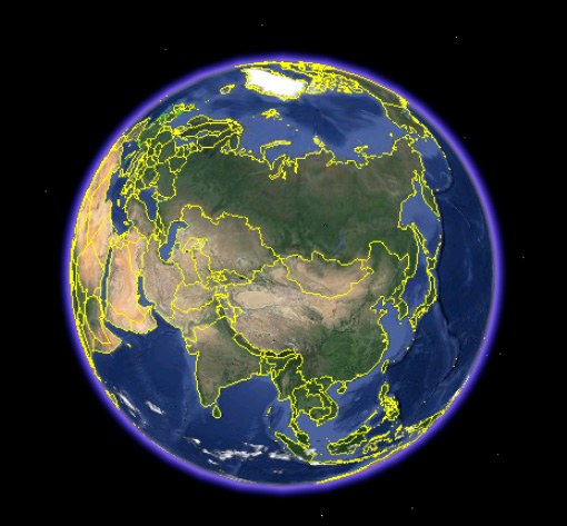
According to the common position, adopted the Prime Meridian the Meridian that passes through the old Greenwich Observatory in Greenwich. Geographical location coordinates can be obtained using GPS. This device receives signals satellite positioning system in the coordinate system WGS-84, common to the entire world.
Models navigators vary by manufacturers, functionality and interface. Currently, built-in GPS navigation exist in some models of cell phones. But any model can record and save the coordinates of the point.
The distance between GPS coordinates
To solve practical and theoretical problems in some industries need to be able to determine distances between points by their coordinates. You can use several ways. The canonical form of representation of geographic coordinates: degrees, minutes, seconds.
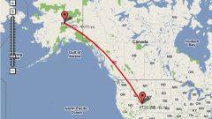
For example, you can determine the distance between the following coordinates: point No. 1 - latitude 55°45'07" n, longitude 37°36'56" V. D.; point No. 2 - latitude 58°00'02" n, longitude 102°39'42" W. D.
The easiest way is to use the online calculator to calculate length between two points. The search engine of the browser, you must set the following parameters to search: online calculator to calculate distance between two coordinates. In the online calculator you enter the values of latitudes and longitudes in the field of query for the first and second coordinates. In the calculation the online calculator gave a result of – 3 800 619 m.
The following method is more time consuming and more intuitive. You must use any available mapping or navigation program. Programs that can create points by coordinates and to measure distances between them are the following applications: BaseCamp (the modern equivalent of the MapSource program), "Google Earth", "SAS.Planeta.
All these programs are available to any user on the network. For example, to calculate the distance between two coordinates in Google Earth, you'll need to create two labels indicating the coordinates of the first point and the second point. Then use the Ruler tool you need to connect the first and second labels, the program will automatically display the result of measurements and show the path on the satellite image of the Earth.
In the case of the above example, the program "Google Earth" has given result – the length of the distance between point No. 1 and point No. 2 is 3 817 353 m.
Why is there an error in the determination of the distance
All calculations of the length between the coordinates is based on the calculation of the arc length. In the calculation of the arc length involved is the radius of the Earth. But as the shape of the Earth is close to the oblate ellipsoid, the radius of the Earth at certain points varies. For distance calculations between coordinates is adopted the average value of the radius of the Earth, which gives an error in the measurement. The greater the measured distance, the more error.