Instruction
1
If you have a portable GPS Navigator, in his memory already made maps of the world, which can be upgraded in connection with special services and a monthly payment for use or for traffic. Not to say that using these cards, you can fully enjoy the view from the satellite (especially not in real time), but as you look closely to the planned route from a bird's flight is quite real.
2
Use the program Google Earth. For this you need to have or Navigator, or cell phone with support for GPRS (and the NMEA Protocol) and the computer.
3
Click on the link http://www.ruslapland.ru/gps.htm and install the version of the program GPS TrackMaker. Install the program Google Earth.
4
In the program window mark on the globe desired parts of the globe. Connect your GPS to the computer and launch the program GPS TrackMaker. Click on the toolbar button "Connect network", then the NMEA (or model Navigator).
5
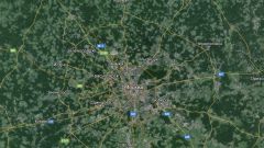
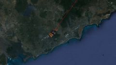
Click Google Earth to start the connection. To request a program on connecting to the Internet first hit "No" (as all the maps selected on the globe, already stored in the cache memory of the computer) and look first for the place where you now are, directly from space. After that, connect to the Internet and enjoy the view of the earth from the satellite.
6
Go to the website http://www.n2yo.com and follow the motion of one satellite on the map Google.
7
Take a look at the Earth from space with satellites, forecasters NASA, visit http://climate.nasa.gov/Eyes/eyes.html. But before that you need to install the Mozilla Firefox browser (if you're not using it) to display images.