You will need
- Topographic map, ruler
Instruction
1
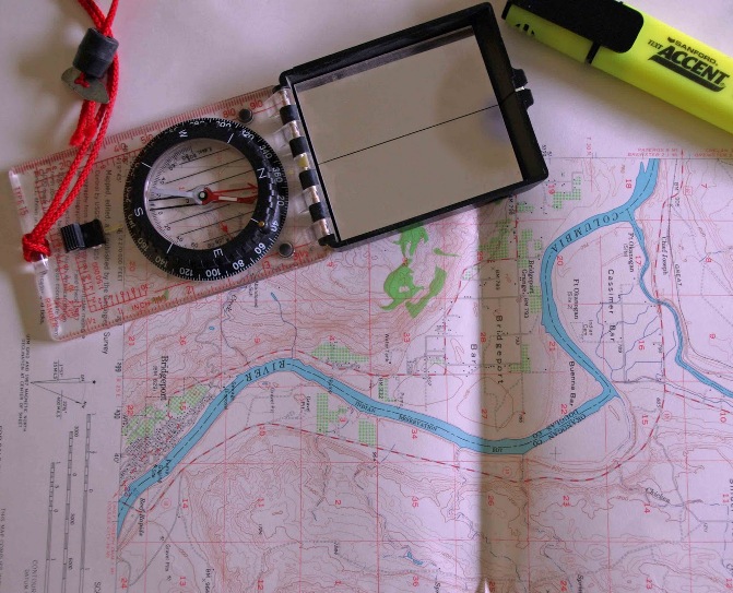
Look closely at the map and find the kilometer grid, which is supposed to be affixed. The sides of the squares of the grid correspond to a certain number of kilometers, to know the quantity you can signatures at the outputs of the line stacks on the edge of the card frame. For example, the distance between two adjacent grid lines is 1 km and Measure this distance with a ruler. Let's say you got 2 see So, the scale of maps: 1 cm to 500 m or 1:50000.
2
The second method of determining the scaleand item cards. Carefully consider the details of the card. The item is a alpha-numeric name of the map sheet. Any scales ' series has its own specific designation under which a specialist can easily determine the scale of the map. For example, the nomenclature designation M-35 means the scale of 1:1,000,000; M-35-XI denotes the scale 1:200000; M-35-18-And-6-1 – scale 1:10000, etc. of Course, to define the scaleand in this way it is necessary to have an understanding of the nomenclature and notation and some experience with topographic maps.
3
The third method of determining the scaleand maps at a known distance. Find on the map image milepost on the highways. Measure the map distance from one pole to the other. You immediately know the scale of the map (the number of inches of cards will match one kilometer area).
4
The maps scaleand 1:200000 on the road marked with distances between towns in kilometers. In this case, measure on the map with a ruler the distance in centimeters from one settlement to another, and signed a number of kilometers, divide by the distance, expressed in centimeters. So you got the value scalemaps, i.e. the number of kilometers in one centimeter.
5
If you are in the area, which is depicted on the map locate the scale on the measured distances. To do this, measure the distance between the mapped objects.
6
Use knowledge of the length of the arc of the Meridian. One minute of the Meridian is equal to approximately 2 km and more precisely is 1.85 km. On the side of the card frame this signature, degree and minute, and every minute allocated to the checkered. If, for example, the length of one minute is equal to 3.7 cm, the scale of the map is 1:50000 (one centimeter on the map equals 0.5 km on the ground).


