Instruction
1
If your card is on paper, find its description called a legend. Most often, it is thermochem design. The legend must contain the map scale, which will tell you how much measured in centimeters distance on this map will be in reality on the ground. So, if the scale is 1:15000, this means that 1 cm on the map equals 150 meters on the ground. If the map scale is 1:200000 1 cm, pending it is 2 km in reality
2
Measure the distancethat interests you. Note that if you want to determine how fast you can walk or drive from one house to another city or from one settlement to another, then your route will consist of straight line segments. You will not move in a straight line, and trails along streets and roads.
3
In fact, the distance between the start and end point of your path is longer than the distancemeasured between the start and end points of the path. The measurements were accurate, put on the map the route of your movement in the form of short and long straight lines, determine their amount and find out actual distancethat you need to overcome.
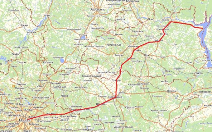
4
To determine distance via the map, you can use one of the many GIS programs that you can find on the Internet. There are specialized programs used by the transport company. By setting the start and final destination, town, you can get a card which will be caused to route your route and it shows the total distance and the distance between the nodal points of the route.
5
Distance on the map can be measured using the Ruler tool GIS packages, Google Earth and Yandex Maps, the underlying cause for the cards which are space satellite images. Just select this tool and click on the point that marks the start of your route and where it will be finished. The distance value can be learned in any given unit of measure.