Instruction
1
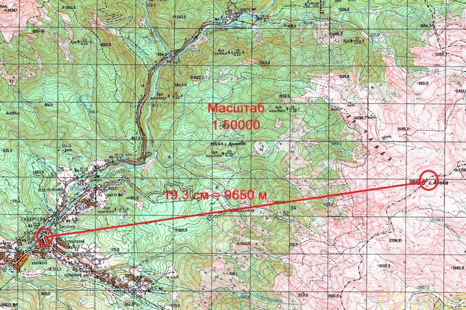
Determine the map scale. He's always indicated in its legend text, accompanied by maps. Is a matching unit on the map to distance on the ground. So, the scale of 1:5000 means that 1 cm of the map equals 5000 cm or 50 m on the ground.
2
To determine distance on the map you need to those objects, the distance between which you are going to define, was marked on the map. The larger the map scale, that is, the lower the number standing for unity in scale, the greater the detail of the card. So, if you want to determine the distance between the buildings in the city, then you need a map scale from 1:2000 to 1:10000, on maps of smaller scales structures have not displayed. If the distances between the settlements, you will need maps of the scale 1:10000 and above.
3
Locate on the map objects the distance between which you will determine. If they are not marked on the map, you put them very much on their location on the ground. So, if you know what object is located near the road intersection, find the intersection on the map and mark it with a dot. If one of the objects – the top of the mountain, find on the map the highest point of the terrain in the area where the mountain is located.
4
Swipe between two points is a straight line and measure it with a ruler. Translate the centimeters measured on the map to distance on the ground in accordance with the scale indicated on the map.
Useful advice
If you want to measure the length of the route, consisting of several dots mark the nodal point of the route on the map, connect them by straight lines, fold them the overall length and translate into real distance using the scale value.