Instruction
1
If the card is printed in paper form, then it must specify a scale ratio of distance on the map to real distance on the ground. Figures of 1:10,000 means that 1cm on the map corresponds to 100 metres in reality. The lower the number specified after the unity, the larger the scale the more detailed is your map. On maps of scale 1:25000 and larger, you can even see trails.
2
In that case, when are you going to walk over rough terrain, using existing roads and trails, you need a large-scale map, where they are applied. You also need the knowledge of the topographic symbols are usually defined in the legend of this map. So, the Hiking trails they traditionally are marked by dashed lines, roads with asphalt coating – two solid parallel lines. Find on the map the start and end points of your route and route it using the symbols. Knowing the scale, you can also define the distance that you have to overcome and to estimate the travel time and the necessary supply of provisions.
3
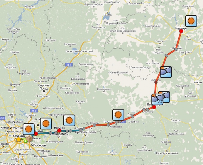
Motorists today to pave the route became much easier. In the Internet there are many sites where by setting a start and end point of the path, you can get the detailed version of the route. You even can specify the options of optimization for speed or distance. You will also have the opportunity to see the weather forecast for the entire route and places to stay and eat, points of tire and even the traffic police post. Of course, on such a map the distance from the start and end point will be determined automatically with a high degree of accuracy – up to 1 km.