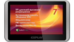
Description of navigators Explay
Navigators Explay are quite large and comfortable screen. Many models, in addition to its primary function – navigation, can be used as an audio and video player, support e-book and built-in radio.
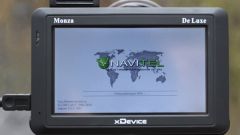
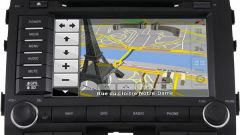
The most important function in the Navigator navigation. The navigators Explay scheme is used to simultaneously support two global positioning systems - GPS and GLONASS, which increases the accuracy of the positioning. The navigators Explay used software iGO, Navitel or Cityguide.
Setup Navigator
Properly installed custom settings – the key to convenient and comfortable use of the device.
First we need to configure a custom map. The use of maps iGO, Navitel or Cityguide Navigator you must specify for each card the way. For example, for map Navitel the path will look like the following образом:\SDMMC\NaviOne\NaviOne.exe.
To select the desired map, need to click on the corresponding icon in the Maps section. After selecting the desired map, set map settings. To do this, under "Menu" select "Settings" tab. Then you should go to "Cards" section and set the top of the map. You can also select the "Spin motion". After applying this setting, the map will rotate during the movement of the car. The display of the Navigator is the same as the view from the window.
Next you need to go to "Navigation". This section configures the mode of transport – pedestrian, car, motorcycle etc. it is Necessary to choose the appropriate mode of transport. In the section "Pull" it is necessary to set either auto mode or set the parameter equal to 50 meters.
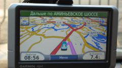
After the basic settings you need to choose the route. In the corresponding menu to choose one of the suggested routes – short or fast. After selecting the route in the section "What to avoid during the route check points which should be avoided. Follow route will be accompanied by voice prompts.
All custom settings for maps and navigation will work if installed on the Navigator Explay official card maker software.