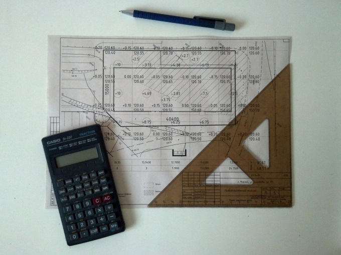
You will need
- paper, ruler and pencil or software drawing;
- calculator.
Instruction
1
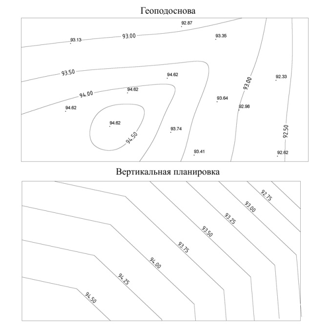
Initial data for KZR is the geological and vertical planning of the territory. On the geological should be given the existing elevations. Usually they are listed as individual points or contour lines. Drawing vertical layout shows the design ground level.
2
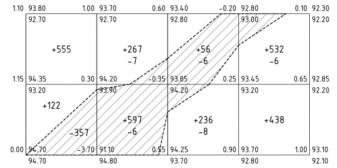
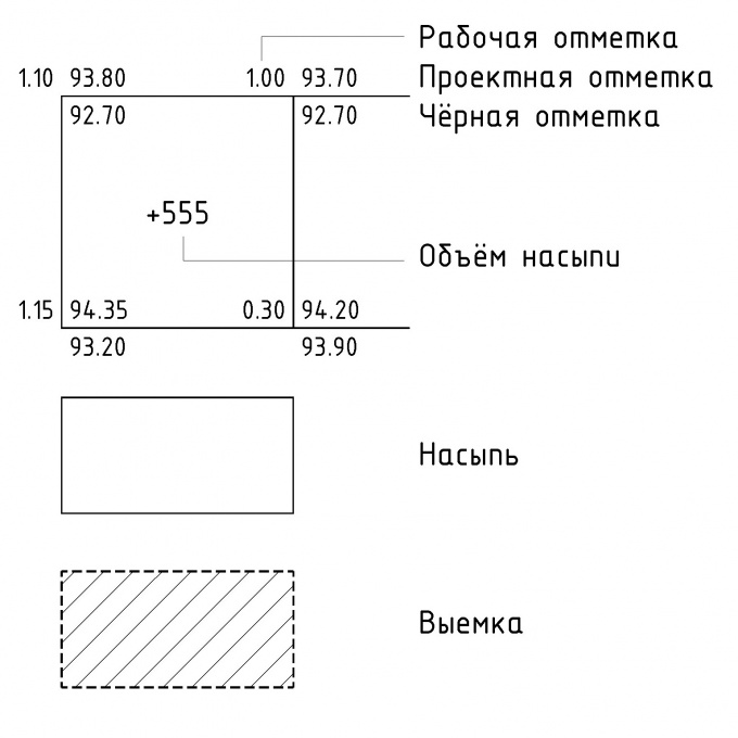
The plan must be applied to a grid of squares with sides of 10 m or more, depending on accuracy. In each corner of the square need to enter black (existing) and red (project) level, and operational level representing the difference between red and black. It is obvious that the corners of the squares may not coincide with the wellknown marks, in this case, they are calculated by interpolation.
Positive working mark means a mound and marked with a sign "+", East Kazakhstan state mean of the recess and are marked with "-". If on the side of the square are positive and negative working level between the calculated zero point (also interpolated). Connecting these points, draw a line of zero works, that is, the boundary between excavation and embankment.
Positive working mark means a mound and marked with a sign "+", East Kazakhstan state mean of the recess and are marked with "-". If on the side of the square are positive and negative working level between the calculated zero point (also interpolated). Connecting these points, draw a line of zero works, that is, the boundary between excavation and embankment.
3
Next calculate the volume of cut and fill for each square. You need to multiply the average mark for the area of a square. For example, if the corners of the square turned out mark: 1.10, 1.00, 1.15 and 0.30, and a square of side 25 m, the volume of the embankment will be equal to: ((1.10 + 1.00 + 1.15 + 0.30)/4)*(25*25)= 555 (m3).
If the square is separated by a line of zero works, the volume may need formula of area of triangle or trapezium.
In the end, the volume of cut and fill all squares are folded and receive the total amount of cut and of fill. Comparing these volumes, teaches the balance of the earth.
If the square is separated by a line of zero works, the volume may need formula of area of triangle or trapezium.
In the end, the volume of cut and fill all squares are folded and receive the total amount of cut and of fill. Comparing these volumes, teaches the balance of the earth.
Note
It is estimated the volume of the earth corresponds to the amount of naturally occurring soil in the dense body. To account for the increase in volume due to loosening during development, the resulting cartogram, the volume should be increased by a factor of razryhlitel.