You will need
- Smartphone with GPS, A-GPS Android 4.2
Instruction
1
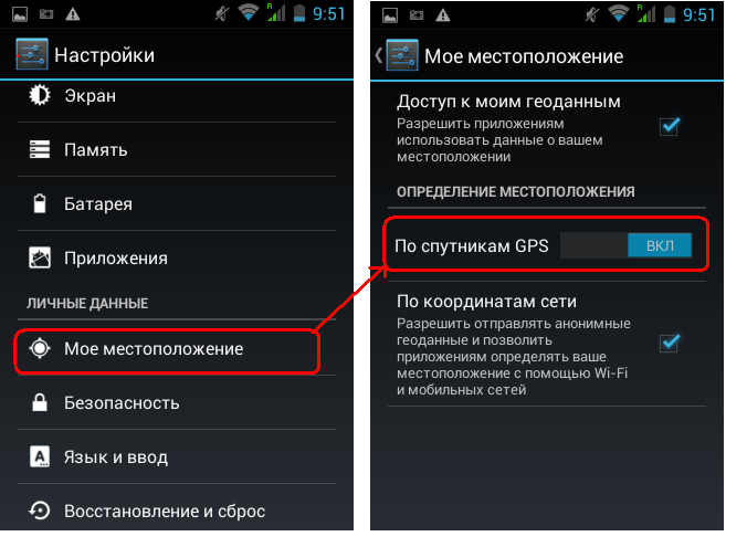
So, first you need to enable on the smartphone positioning by GPS satellites and tick "mobile network location".
2
Now it is necessary to conduct the GPS test device. To do this, download Malware, program, I liked the simple GPSfix.
3
Before you start testing the GPS, it is necessary to remember a few conditions:
a) Go outside (preferably an open area like a stadium or Park).
b) Try 15 minutes to stay in one place, not to move down the street, not to go to transportation, not to go to the stores or jump time, you need to warm up the system, called "cold start". Then when the program Navigator can be moved, to move the car (but not on the trolley — it can interrupt the satellite signal).
Click Start or fixing a special icon in the form of a circle and see the time that the program spends on the detection of satellites. Can receive up to 12 satellites (on high terrain), but usually 5-6, and after a time will appear like lon coordinates are 44°57'49.0"N, lat 34°06'20.0"E and azimuth. And if the room, I will write No Fix - not fixed.
4
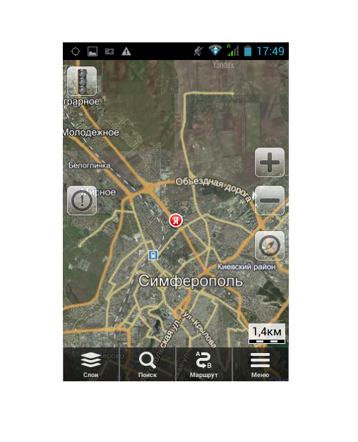
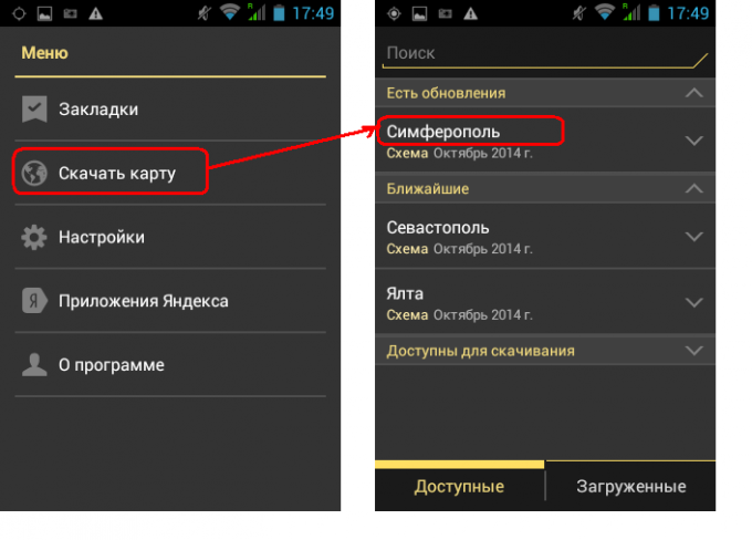
Now we need the maps for offline the GPS. These cards can be downloaded and used free of charge in these programs: YandexMaps, Be-on-Road, MapsFactor, the last two in 3D versions. Maybe there are others, but you download and apply the cards have been just them. Google maps for Android 4.2 is not downloaded at all.
About Yandex-cards note that to download the available only large cities, but for the forest it is irrelevant.
About Yandex-cards note that to download the available only large cities, but for the forest it is irrelevant.
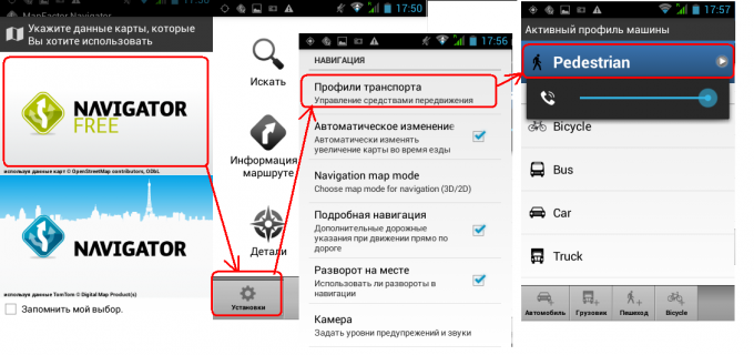
5
It is very important in the program settings MapsFactor to put "Setup-Profiles" transport — Pedestrian (Pedestrian), or when configuring the route, easy to get lost. There is a scoring route voice. The downside is the departure point and destination at very difficult to choose, you have to click on the map at random.